Lake Tahoe is famous for its stunning mountain tops and expansive hiking trails. I have compiled a list of the must visit peaks in the region. These are great to tackle in the late summer when the snow has melted and the weather is still calm and warm.
The Big Ones
Freel Peak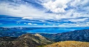
Freel Peak is the tallest peak in the Tahoe area at 10,886 ft. The views are expansive and the hike is long, exposed, and difficult but well worth the effort. Be sure you are prepared with plenty of water and food, as well as checking the weather before you head out because lightning can be an issue. This is a 10 mile out and back hike with 2,700 ft of elevation gain.
From the intersection of Hwys 50/89 in Meyers, CA, take SR 89 south approximately 9-10 miles until you reach FS 051. The road is on the north side of SR 89 and turns to dirt immediately after you pass the service road’s gate. The trail also requires 4WD vehicle on Forest Service Rd 051. Be sure your vehicle is equipped, and the gate is open (it is usually closed November 1- May 31st. The parking area to access Armstrong Pass, the Tahoe Rim Trail, and Freel Peak is an open dirt lot approximately 3.5 miles up the dirt road from the gate. The parking area is on the left side of FS 051 (as you travel up the road) and it’s just past the second small bridge.
For an in depth description of the trail and directions click HERE
Mt. Rose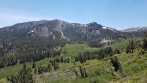
Mt. Rose is the third highest peak surrounding Lake Tahoe and offers amazing views of both the Tahoe Basin and the Carson Valley. It is a well-traveled, strenuous trail that is well worth the time and effort. The trail is an 11 mile out and back with 2,500 ft of elevation gain, with a waterfall, wildflowers, and expansive views.
From SR 431-Mt Rose Hwy park at the Mt Rose Summit parking lot which provides access to several trails including Galena Falls, Tamarack Peak, Relay Peak and the Tahoe Rim Trail. Follow the trail for Galena Falls and then once past Galena Falls the Mt Rose Summit trail branches off to the north east from the Rim Trail.
For a detailed description of the trail and maps click HERE
Mt. Tallac
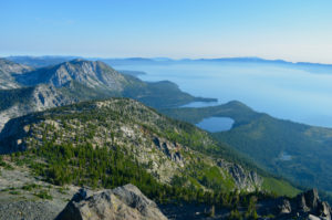
Mt. Tallac is one of the highest peaks in the basin and a favorite hike for spectacular views. Mt Tallac is 9,739 ft in elevations and sits above Fallen Leaf Lake and Emerald Bay.
The trailhead is located approximately 3.5 miles north of South Lake Tahoe on Hwy 89. Look for the Mt. Tallac Trailhead sign directly across from the entrance to Baldwin Beach.
Turn left down the dirt road and continue to the trailhead parking. A wilderness permit is required. Day hikers, pick up your permit at the self serve area at the trailhead. Overnight hikers will need an overnight permit for Desolation Wilderness. This permit must be purchased before you get to the Mt. Tallac Trailhead. Mt. Tallac Trailhead receives high use and is thus well marked. There are three main trails:
- Floating Island Lake – one-way mileage is 1.7 miles. Difficulty level is easy to moderate.
- Cathedral Lake – one-way mileage is 2.5 miles. Difficulty level is easy to moderate.
- Mount Tallac – one-way mileage is 5 miles. Difficulty level is difficult.
For details and trail maps click HERE
The Not so Well Known But My Favorites
Rubicon Peak
![]() Rubicon Peak is located on the East shore off of Hwy 89. It is a short hike with a fun rock climb at the top rewarded with stunning views. The trail is not well known and usually very quiet. It is about 4 miles round trip but it is steep and requires some bouldering. It is family friendly, for kids who can scramble up boulders!
Rubicon Peak is located on the East shore off of Hwy 89. It is a short hike with a fun rock climb at the top rewarded with stunning views. The trail is not well known and usually very quiet. It is about 4 miles round trip but it is steep and requires some bouldering. It is family friendly, for kids who can scramble up boulders!
To access the trail you must turn off Hwy 89 at Highview Drive and wind your way through the neighborhood finding a parking spot at the end of the Highview Drive. The trail starts as a dirt road and then becomes singletrack with easy hiking in a dense forest that leads to a bit of a saddle point, where you get nice views to the south and bits of the lake. At this point the trail gets rocky and is marked with cairns. There is no best way to get to the top , just pick your way over the talus and boulders to the peak. Once you’ve taken it all in, carefully make your way back through the talus slope to return to your car.
For a map and detailed trail information click HERE
Ellis Peak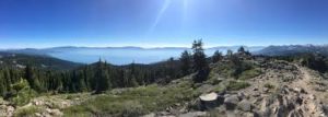
Is located off of Barker Pass on the West shore of Lake Tahoe. This trail offers great views of the Lake, Twin Peaks, and Desolation Wilderness as well as wildflowers even into late summer. It is not a busy trail and there is a lot of room at the peak to sit and enjoy the expansive view of Lake Tahoe. It is a 6.4 mile out and back trail.
To access the trail take Blackwood Canyon exit off Hwy 89 and follow the road up to Barker Pass. Just as the road turns to dirt there will be a parking lot on the left hand side for the Ellis Peak Trail head. The trail is a steep switchback for the mile and then opens up to an expansive ridge line and a gradual climb with stunning views all the way to the peak.
For detailed trail information and maps click HERE


Leave a Reply